When we left Woodstock, time dictated that we head west by
the quickest route which was through the northern States to Manitoba.
On the west coast and the Fraser River we are used to miles
of train cars, freighters and log booms. They are a normal part of our coastal
lives.
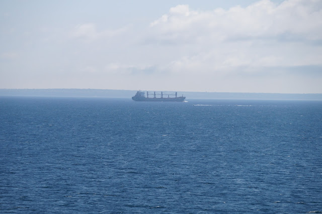
On this trip we first encountered the St. Lawrence River in
Quebec City. We saw freighters on the river but didn’t pay much attention to them.
Again, in Brockville we saw freighters on the same river and
even further from the ocean.
We crossed into the US from Sarnia, Ontario to Port Huron,
Michigan.
That gave us our first glimpse of Lake Huron - and more
freighters.
Now something started to click. We were hundreds of miles
from the ocean and still seeing freighters. In western Canada there are no
lakes big enough for freighters. This was another time where we understood
something we had only read about – the St. Lawrence Seaway and the vastness of
the Great Lakes.
Driving accross Michigan we saw Lake Michigan
and Lake Superior. At that point we had seen all of the Great Lakes on this
trip (Lake Ontario and Lake Erie while we were in Ontario).
We crossed the top of Wisconsin and spotted local industry
with a Canadian connection.
In Minnesota we didn’t see a campground on our route until
near Grand Rapids. As we were wondering what we might find for the night we
passed Sal’s Campground. It was not on any map or list that we had but we were
ready to stop. Ralph found a place to turn around and we went back to find a
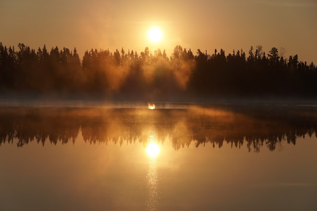
small campground beside a lovely lake.
The manager saw me photographing the lake in the evening.
He
suggested the view was even better in the morning when the mist was still on the
lake. What a beautiful, unexpected, unplanned morning.
After the sun has risen the final treat swam out from under
the pier.
Rugby, North Dakota is the Geographical Center of North
America. We were in the “middle” of our trip.
We crossed from North Dakota into Manitoba at the
International Peace Garden.
In 1932 an estimated 50,000 people attended the opening of the
International Peace Garden which celebrates the peaceful coexistence of Canada
and the United States of America.
Until 1982, the focus of the International Peace Garden was
its gardens and the vast open skies that mark the openness of the 49th
parallel.
The Peace Towers were built in 1982 to celebrate the 50th
anniversary of the Garden. On the crest of a hill on the 49th
parallel, the set of towers were erected as a symbol of peace that reaches across the longest
undefended border in the world.
The original formal botanical garden leads the eye directly
to the Peace Towers.
The Peace Chapel provides a calm site for contemplation
about what peace means to each of us.
The walls provide introspective quotes from the famous to the
anonymous.
This is one of over 8,000 cairns that mark the 49th
Parallel. The boundary “vista” is cleared to a 20 foot/6 metre width through
forested areas. More than 5,525 miles/8,891 kms of land and water boundaries
are kept clear of obstructions.
The Interpretive Centre houses a Conservatory with over
6,000 thriving cacti.
This cacti feature hints at the 2,339 acres of prairie
wilderness adjacent to the Gardens in Manitoba and North Dakota.


Great photos...thanks for sharing your journey with us. Keith and Karen Weimer recently visited us for a few days (as you have also occasionally done). We spent three pleasant days catching up. where we learned of your broken & healing bones Linda. Our prayers are that you are fully recovered or are well on the road to recovery (yet another journey!)
ReplyDeleteIt's like being there with you. Indeed, exceptional photography. I didn't know those little box cameras from Kodak could do that.. :)
ReplyDelete